
What makes a road trip worth the gas money? The best road trip routes in the us share three traits: scenery that earns every mile, services where you need them, and a pace that lets you look out the window. This guide covers seven of them as of 2026. You’ll get seasons, closures, park pass costs, and who each road suits.
Short on time? Pick the Pacific Coast for variety, Route 66 for history, and the Blue Ridge Parkway for slow, scenic miles, once you’ve checked storm closures.
Why the Best Road Trip Routes in the US Aren’t Always the Longest
A longer road doesn’t mean a better trip. Fifty miles of mountain pass can fill a whole day. A 2,448-mile highway can swallow three weeks. So the smarter question isn’t “how far?” It’s “how many miles will I really cover each day, and what will I stop for?”
Anyone who has tried to squeeze Big Sur into one afternoon knows the feeling. You spend the day staring at brake lights instead of cliffs.
Three filters sort most routes fast:
- Daily mileage. Mountain roads crawl, so plan fewer miles than your map app suggests.
- Season. Some roads close for winter. Others run into hurricanes or desert heat.
- Services. Fuel, food, and cell signal can vanish for hours on the prettiest stretches.
Keep those three in mind, and every route below gets easier to judge.
Blue Ridge Parkway: The Slow-Lane Classic
The Blue Ridge Parkway runs 469 miles from Virginia into North Carolina. It links Shenandoah National Park with Great Smoky Mountains National Park. The speed limit never tops 45 mph, there are no stop lights, and the road is free.
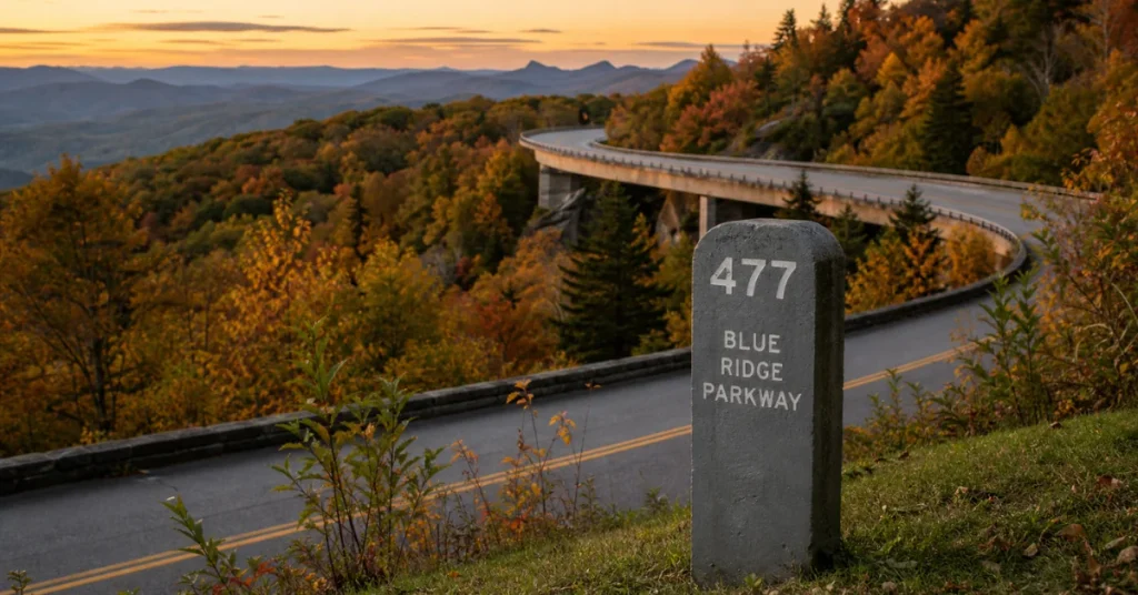
Here’s the part many guides skip. Hurricane Helene tore through western North Carolina in late September 2024, and the parkway took a beating. Crews found at least 57 landslides, and repair costs top $1 billion. Most of the road has reopened. Even so, a recent local report put the closed section at roughly 40 miles, with a target finish at the end of 2026.
So check the live closure map before you leave, and keep a backup route on US highways. Expect heavy construction trucks on the open stretch between Asheville and Mount Mitchell State Park.
That slow pace is still the point. Mileposts count up from the Virginia end, and nearly every stop gets located by number. Mount Mitchell, the highest peak in eastern North America, sits just off the road at milepost 355.4 along NC 128. Confirm that access is open, since it’s close to the repair zone. Near Asheville, the Folk Art Center at milepost 382 is a good place to stretch your legs.
Gas stations sit in nearby towns, not on the road itself, so top off the tank before you start. Winter closes the high sections, and most visitor facilities run from April or May through October. Fall color is underway or close this month, and holiday weekends get crowded around Roanoke and Asheville.
Who it suits: families and anyone who’d rather cruise than race. Give it two or three days.
Route 66: The Mother Road Turns 100
Route 66 is 100 years old in 2026, and the party shows. The 2,448 miles from Chicago to Santa Monica cross eight states: Illinois, Missouri, Kansas, Oklahoma, Texas, New Mexico, Arizona, and California. The number 66 was assigned on April 30, 1926, and the highway was made official that November 11.
Here’s the twist. The road left the national highway system in 1985, after interstates replaced it. Today you’re stitching together old alignments, frontage roads, and preserved stretches. Parts of Illinois, Missouri, New Mexico, and Arizona carry a National Scenic Byway label as Historic Route 66.
Think of it as a museum with no roof and no closing time. Neon motels, roadside diners, and small-town main streets fill the gaps between cities. Expect a multiweek trip. Download offline maps too, since older alignments don’t always match the signs.
Centennial events have run all year, from the Springfield, Missouri kickoff to celebrations at the Santa Monica end. Check local calendars for what’s still coming this fall.
Pacific Coast Highway: Big Sur and Beyond
California’s coastal highway runs roughly 655 miles from San Francisco to San Diego. The showpiece is the stretch from Monterey to San Simeon. Cliffs, redwood shade, and the elephant seal rookery at Piedras Blancas all compete for your attention. April through October is the sweet spot.
Two practical warnings. Winter landslides often close sections south of Big Sur, so check Caltrans QuickMap before you leave. And break-ins have been reported at popular trailhead lots near Pfeiffer Falls and McWay Falls. Keep bags and electronics out of sight.
Only have a weekend? Los Angeles to Santa Barbara gives you a compact version of the same coastal magic. You’ll still get ocean views, beach towns, and a long lunch.
Who it suits: couples, photographers, and first-time visitors to California.
Going-to-the-Sun Road: Fifty Miles With No Filler
Glacier National Park’s signature road crosses the Continental Divide at Logan Pass, 6,646 feet up. The full 50 miles opened on June 22 this year, a little later than usual because of snowpack. It typically closes by mid-October, so timing matters right now.
Size rules are strict. Vehicles longer than 21 feet or wider than 8 feet are banned between Avalanche Creek and Rising Sun. Rangers do measure.
For 2026, the park dropped vehicle reservations. A ticketed Logan Pass shuttle, priced at $1, started on July 1 to ease parking pressure. Cell service is thin to nonexistent in most of the park. Rules move from year to year, so check the park’s page the week you go.
Three More Routes Worth the Gas
Utah’s Mighty Five
Zion, Bryce Canyon, Capitol Reef, Arches, and Canyonlands make up the best-known national park circuit in the country. Red rock towers over the road, and many viewpoints need only a short walk. Summer heat is harsh out there. Spring and fall treat you much better. Zion and Bryce Canyon also sit on the list of parks with special fee rules for non-US visitors (see the pass section below).
The Overseas Highway
This road runs down the Florida Keys to Key West. It works well as a short, warm-weather escape, and two or three days is plenty. Hurricane season runs through November 30, so watch forecasts closely if you’re heading south this month.
Colorado’s Stargazing Trail
New in 2026, Colorado’s tourism board teamed up with Dark Skies International on a self-guided stargazing route with an online map. It strings together places like Mesa Verde and Great Sand Dunes National Park. Star parties and astronomy festivals dot the way. It’s the newest idea on this list, and the only one designed for after dark.
The Routes Side by Side
| Route | Length | Best time | Best for |
|---|---|---|---|
| Blue Ridge Parkway | 469 miles | Spring to fall, peak color in autumn | Families, slow scenery |
| Route 66 | 2,448 miles | Spring or fall | History, long trips |
| Pacific Coast Highway | About 655 miles | April to October | Coastal scenery |
| Going-to-the-Sun Road | 50 miles | Late June to early September | Mountain views |
| Utah’s Mighty Five | Varies by loop | Spring and fall | Hikers, photographers |
| Overseas Highway | Short, 2 to 3 days | Winter and spring | Quick escapes |
| Colorado stargazing trail | Varies | Summer and early fall | Night sky fans |
Check Before You Go
Every great road has one thing that can ruin the day. Here’s what to look up for each route before you leave:
| Route | What can slow you down | Where to check |
|---|---|---|
| Blue Ridge Parkway | Helene repairs, detours, winter closures | Park Service live closure map |
| Pacific Coast Highway | Landslides south of Big Sur | Caltrans QuickMap |
| Going-to-the-Sun Road | Mid-October closure, 21-foot vehicle limit, shuttle rules | Glacier park website |
| Overseas Highway | Hurricane season through November 30 | National Hurricane Center forecasts |
| Route 66 | Busy centennial towns, full motels | Local event calendars |
The Park Pass Math Most Guides Skip
Several of these roads run through national parks, so entrance fees matter. Glacier, for example, charges $35 per vehicle in 2026. And since January 1, the rules have a twist for visitors from outside the US.
Here’s how the America the Beautiful annual pass works this year:
| Traveler | Annual pass | Extra fee at the 11 busiest parks |
|---|---|---|
| US resident | $80 | None |
| Non-US resident | $250 | None with the pass; $100 per person without it |
| Eligible US senior | $20 annual or $80 lifetime | None |
The 11 parks with the surcharge include Glacier, Zion, Bryce Canyon, Rocky Mountain, Yellowstone, Yosemite, and the Grand Canyon. Three more details help you plan:
- One pass covers a private vehicle and up to four adults. It doesn’t cover camping, permits, or ticket reservations.
- Passes are now available in digital form, and fee-free days apply to US residents only.
- A draft bill in Congress could raise the US price to $100 in January 2027. Nothing is final, so check before you buy.
Now the math. Glacier’s $35 vehicle fee shows it: three parks at that price already top $80. For visitors from abroad, a couple visiting two of the surcharge parks without a pass would pay $400 in surcharges alone. The $250 pass usually wins. The Blue Ridge Parkway, meanwhile, charges no entry fee at all, which makes it the budget pick.
What the Research Shows
The Blue Ridge Parkway logged 16,533,753 visits in 2025. That’s a lot of people sharing one slow, two-lane road. It explains why weekday trips and early starts pay off.
Reading 2026 park notices and route guides side by side, a pattern stands out. The trouble rarely comes from the scenery. It comes from logistics: a pass closed by snow, a storm-damaged stretch, a fuel gap, a dead cell zone, or a vehicle too long for the road.
Rules also move fast. Glacier required timed-entry reservations on its famous road in 2025. This year they’re gone, and a shuttle ticket took their place. National park fees moved too, with new rules for non-US visitors starting in January. Route 66 adds another twist, since the centennial year means busier small towns. Expect full motels on weekends.
Matching the Best Road Trip Routes in the US to Your Season
Timing decides whether a great route becomes a great memory. A quick guide:
- Spring: Utah’s parks and the California coast feel comfortable. Route 66 starts easy in the south.
- Summer: Glacier’s full road is open, and Colorado’s dark skies shine.
- Fall: The Blue Ridge Parkway wears its autumn color, and Utah’s heat finally eases.
- Winter: The Overseas Highway and southern stretches of Route 66 stay friendlier than mountain roads.
It’s October 1 right now, so here’s the real-time version. The Blue Ridge Parkway has color and a few closures. Utah has mild weather. The Keys still carry storm risk. And Glacier is a race against the mid-October closure.
Who Should Take Which Road
The best road trip routes in the US don’t fit everyone equally. Match the road to your group:
- Families with young kids: The Blue Ridge Parkway works well. There are no stop lights, plenty of pullouts, and a gentle speed limit. Just check closures first.
- RV owners: Check length and height limits before committing to any mountain road. Glacier’s 21-foot rule is the strictest example here.
- Electric-car owners: Remote stretches like Big Sur, Glacier, and the parkway itself have thin services. Plan charging before you enter them.
- Visitors from outside the US: Budget for the $250 pass or the $100 per-person surcharge if your route includes Glacier, Zion, Bryce Canyon, or Rocky Mountain.
- Weekend travelers: Los Angeles to Santa Barbara or the Keys fit a long weekend nicely.
- History fans: Pick Route 66, even if you only do a few states.
Six Checks Before You Turn the Key
- Open the official road status page the morning you leave.
- Download offline maps, because signal disappears on the best roads.
- Top off fuel or charge at every decent chance.
- Keep valuables out of sight at trailhead lots.
- Sort out your park pass before you reach the first gate.
- Book lodging ahead of time for centennial towns and autumn weekends.
Final Thoughts on the Best Road Trip Routes in the US
The best road trip routes in the US reward planning more than mileage. Pick a road that fits your season, your vehicle, your budget, and your patience. Then leave room for the unplanned stop, because that’s usually the one you’ll remember. Start with the Pacific Coast or Route 66 if you want a sure thing this year. Take the Blue Ridge Parkway once you’ve checked the repair map.
FAQs
What are the best road trip routes in the US for first-timers?
The Blue Ridge Parkway is a gentle start. It’s free, slow, and has no stop lights. Check current closures first, since storm repairs are still underway. Route 66 and the Pacific Coast are great next steps.
How long does Route 66 take?
Plan on a multiweek trip. With less time, pick two or three states and do them well.
Is Going-to-the-Sun Road open right now?
It usually closes around mid-October, and weather decides the exact date. Check the park’s road status page before you head out.
Do I need a national park pass for a US road trip?
Only if your route enters fee-charging parks. The Blue Ridge Parkway is free, but Glacier and Utah’s parks charge. US residents pay $80 for the annual pass in 2026, while non-residents pay $250.
Are there good road trips for just a weekend?
Yes. Los Angeles to Santa Barbara and the Overseas Highway both fit a two- or three-day window.